
Check before you go: the cave interiors on this walk are open seasonally and visited by guided tour only, so opening days and hours change through the year. The open-air Voie Sarde path itself can be walked independently, but check the official Grottes de Saint-Christophe site before travelling, especially outside summer.
Why this walk is different
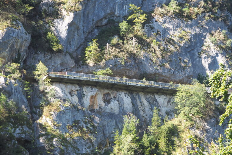
Most Chartreuse walks sell you scenery. This one sells you a road – and it is worth it. The Voie Sarde, the Sardinian Road, is a stretch of historic highway cut through the gorge of the Guiers Vif, just east of Les Échelles and a short drive from Entre-deux-Guiers. For centuries it was the main route between Lyon, Chambéry and Turin, squeezed through a canyon where Savoy met France. Walking it today means climbing a stone ramp built for horse-drawn carriages, passing under cliffs where water still seeps through the rock, and standing in front of a 20-metre monument to the duke who ordered the road built.
It is also the easiest history walk in the valley. The classic version is short and gently graded – a shaded climb rather than a mountain hike – and it pairs naturally with the guided caves of Saint-Christophe, which sit on the same site. If you want one walk that gives visitors a story to take home, rather than just a view, this is the one.
A short history of the road
The route through this gorge is far older than the road you walk on. The Romans used this passage on the Lyon–Chambéry–Turin corridor, and the Voie Sarde follows the line of that ancient road. By the 17th century the old Roman way had fallen into ruin, and the gorge was once again a difficult, steep passage.
Between 1667 and 1670, Charles-Emmanuel II, Duke of Savoy, had the road rebuilt as a royal road fit for carriages – the Voie Sarde, the Sardinian Way. The centrepiece was a monumental ramp of dressed stone, some 400 metres long, engineered up the side of the gorge. A monument to Charles-Emmanuel II, around 20 metres high and now listed as a historic monument, was built into the rock face to commemorate the work.
Famous travellers used the road in its heyday, including Jean-Jacques Rousseau and Pope Pius VII, who passed through in 1804 on his way to crown Napoleon emperor. But the road’s steep terraces were always awkward for traffic, and in the early 19th century a tunnel ordered under Napoleon bypassed the gorge altogether. The Voie Sarde lost its role as a highway and survived as what it is today: a walker’s route and a piece of open-air heritage, with the modern D1006 running through the tunnel nearby.
One local legend belongs to the caves rather than the road, but you will hear it on site: the lower cave is said, according to legend, to have been a refuge of Louis Mandrin, the famous 18th-century smuggler of the Dauphiné-Savoy border country. Treat it as legend – it is a good story, and the border-smuggling history of this valley makes it an easy one to believe.
The walk at a glance
There are two ways to do this walk: the short historic walk, and a longer loop for fit walkers. The short version is the one most visitors want.
- Short walk: the Voie Sarde between Saint-Christophe-la-Grotte and the Grottes de Saint-Christophe reception – about 30 minutes on foot each way, gently climbing, in shade
- Start options: the Chapelle car park at the foot of the Voie Sarde in Saint-Christophe-la-Grotte, or the reception car park (Parking de l’accueil) on the D1006
- Difficulty: easy to moderate – a shaded, gently climbing path, but with stone steps and uneven ground; not accessible to the motor-impaired
- The caves: guided tour only, about 1 hour 20 minutes, visiting two caves with the Voie Sarde walked between them
- Longer option: a loop from Entre-deux-Guiers taking in the Old Saint-Martin Bridge and the Sarde Road, listed at about 14.5 km and around 5 hours – a full-day walk, not an extension of the short one
Note the honest gap in the figures: published sources agree on the 30-minute Chapelle-to-reception walk and the 400-metre stone ramp, but no single official distance is published for the standalone Voie Sarde section, so this guide gives timings rather than an invented kilometre figure. The 14.5 km loop figure comes from a community trail listing, so treat it as an estimate and check the route on a map before setting out.
Getting there from Entre-deux-Guiers
From Entre-deux-Guiers, head through Les Échelles and continue on the D1006 towards Chambéry. The Grottes de Saint-Christophe reception car park (Parking de l’accueil) sits beside the D1006, immediately before the tunnel when coming from Chambéry, and immediately after it when coming from Les Échelles – about 4 km past Les Échelles. There are two free car parks: the reception car park, where cave tours depart, and the Chapelle car park at the foot of the Voie Sarde in the village of Saint-Christophe-la-Grotte.
If you want the classic experience, park at the Chapelle car park and walk the Voie Sarde up to the reception – that way you arrive at the caves having already walked the historic road, rather than driving past it. From the lower end of the Sardinian Way, the walk back uphill to the car park is about 600 metres.
The route, step by step
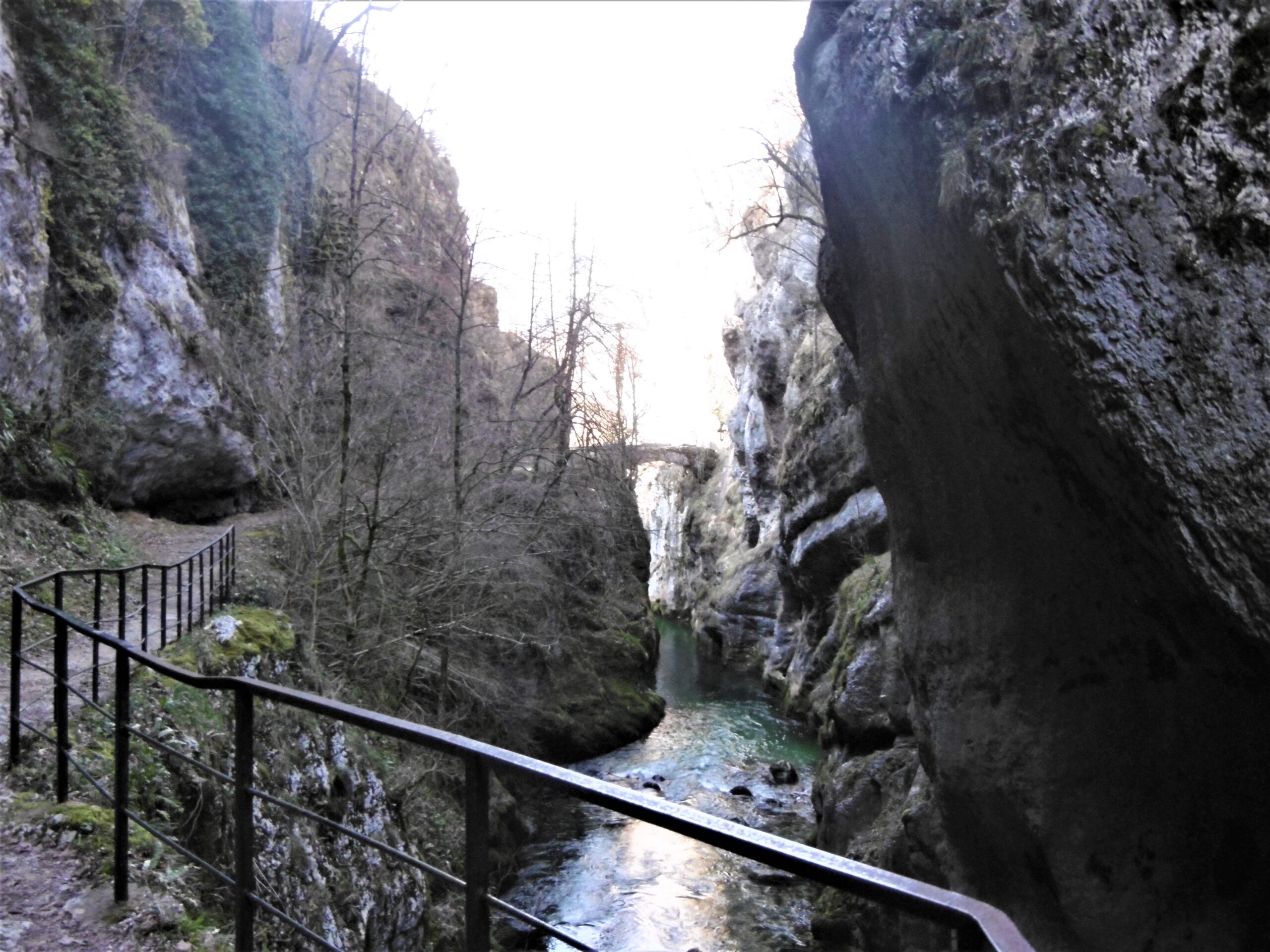
Starting from the Chapelle car park (or the Pont Romain car park in Saint-Christophe-la-Grotte, under the reservoir near the wash house), take the ramp that leads up onto the Voie Sarde, heading towards the Grottes des Échelles. The path climbs gently through shade cast by trees and cliffs, with the sound of water running through the rock never far away – small waterfalls and seepage run down the cliff face in places, and in the right light the spray catches the sun.
The first landmark is the Grotte de la Glacière, then the great dressed-stone ramp itself, and then the monument to Charles-Emmanuel II, built into the rock face. This is the section to slow down for: the ramp is the engineering achievement the whole walk is about, and the monument marks the spot where the duke’s road-building project is commemorated.
From the monument, the path continues up the gorge to a crossroads. If you are doing the short walk, continue to the reception area, where the cave tours begin. The guided tour visits two caves: the first, a still-periodically-active cave with a meander full of giant potholes carved by ancient whirlpools, and the second, a through-cave crossed on a footbridge 20 metres above the ground, opening onto a panorama over Saint-Christophe-la-Grotte and the Chartreuse valley. The Voie Sarde itself forms part of the guided route, walked between the two caves.
After the tour, a worthwhile detour is the Roman bridge, described in visitor guides as about 15 minutes from the end of the tour – a picturesque stone bridge and a good photo stop before you walk back down the Voie Sarde to the Chapelle car park.
The longer loop, for fit walkers
If the short walk leaves you wanting more, a community-listed loop from Entre-deux-Guiers combines the Old Saint-Martin Bridge with the Sarde Road, at roughly 14.5 km and around 5 hours. This is a different kind of day: a proper half-day hike through varied terrain rather than a gentle heritage stroll. It suits walkers who are already comfortable with distance and ascent, and it is best planned with a downloaded map, since waymarking on the longer loop is not described in the sources this guide is based on. Do not attempt it as a casual add-on to the cave visit – treat it as its own outing, starting from Entre-deux-Guiers itself.
Practical checklist
- Footwear: closed shoes with grip – the stone ramp and steps can be damp, and closed shoes are required for the cave tour
- Clothing: bring a warm layer for the caves – the minimum cave temperature is around 9°C, even in summer
- Time: allow about 30 minutes each way for the Voie Sarde walk, plus about 1 hour 20 minutes if you take the cave tour
- Cave entry: guided tours only, with an entry fee – check current prices and opening days on the official site before you go, as both are seasonal (adult entry was listed at €11 at the time of checking, with reduced rates for children and teenagers)
- Access: the caves and the Voie Sarde are not accessible to the motor-impaired; the reception building and bar are
- Dogs: welcome on the surrounding hiking trails, but check the cave policy before assuming they can enter the tour
- Cash: visitor guides suggest bringing cash or change for cave admission
- After rain: the gorge path can be wet and slippery, and the cave site notes that conditions can change quickly after heavy rain – if a section looks unsafe, turn back
Combining it with the rest of the valley
This is a half-day outing at most, so it combines well with the rest of Vallons du Guiers. Les Échelles, a few minutes away, has the valley’s shops and restaurants for lunch afterwards, and Entre-deux-Guiers itself – the village at the meeting of the Guiers Vif and the Guiers Mort – is the natural base for the walk. For a full heritage day, pair the Voie Sarde with the Gorges du Guiers Mort walk near Saint-Laurent-du-Pont: two gorges, two rivers, and two very different chapters of the same valley’s history.
The honest summary
The Sardinian Road walk is not the valley’s most dramatic scenery, and it does not pretend to be. Its appeal is different: you walk a road that carried kings, popes and smugglers between France and Savoy, on stone laid down in 1670, with caves and a Roman bridge thrown in. It is short, shaded, easy to reach from Entre-deux-Guiers, and it gives English-speaking visitors something no trail database can – the story of why this gorge mattered. Go for the caves, stay for the road, and finish with lunch in Les Échelles.